1
/
von
1
1720 Scandinavia complectens Sueciae, Daniae & Norvegiae...
1720 Scandinavia complectens Sueciae, Daniae & Norvegiae...
Normaler Preis
369,00 zł PLN
Normaler Preis
374,00 zł PLN
Verkaufspreis
369,00 zł PLN
Inkl. Steuern.
Versand wird beim Checkout berechnet
Anzahl
Verfügbarkeit für Abholungen konnte nicht geladen werden
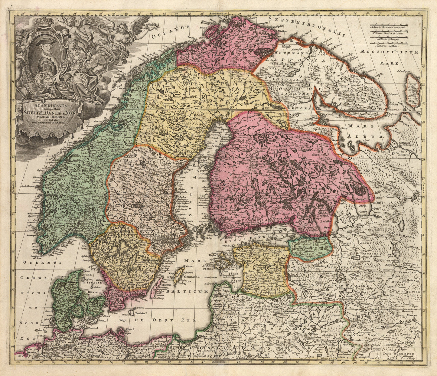
Scandinavia complectens Sueciae, Daniae & Norvegiae Regna ex Tabulis Ion.
By: Johann Baptiste Homann
Date: 1720 (Published) Nuremburg
Original Size: 19 x 22.5 inches (48 cm x 57 cm)
This beautiful folio map of Scandinavia is the work of Johann Baptiste Homann. In addition to Scandinavia this highly detailed map includes Denmark, the Baltic Republics, portions of western Russia, northern Poland and northern Germany.
The map demonstrates the leap in geographical knowledge which was accomplished between the 16th century when Munster published his maps of the area and the early 18th century when Homann was at the height of his career, just five years after being named Imperial Cartrographer by Holy Roman Emperor Charles VI. By this time Scandinavia had been better explored and charted, thus Homann¡¯s geographical details, based on previous maps and more recent exploratory expeditions, are very accurate.
An elaborative figurative cartouche embellishing the map features an angelic herald, allegorical figures, putti, a lion, and an unidentified gentleman seated in the center.
Inventory #10907