1659 Nova Europae Descriptio...
1659 Nova Europae Descriptio...
Cena regularna
369,00 zł PLN
Cena regularna
374,00 zł PLN
Cena promocyjna
369,00 zł PLN
Z wliczonymi podatkami.
Koszt wysyłki obliczony przy realizacji zakupu.
Ilość
Nie można załadować gotowości do odbioru
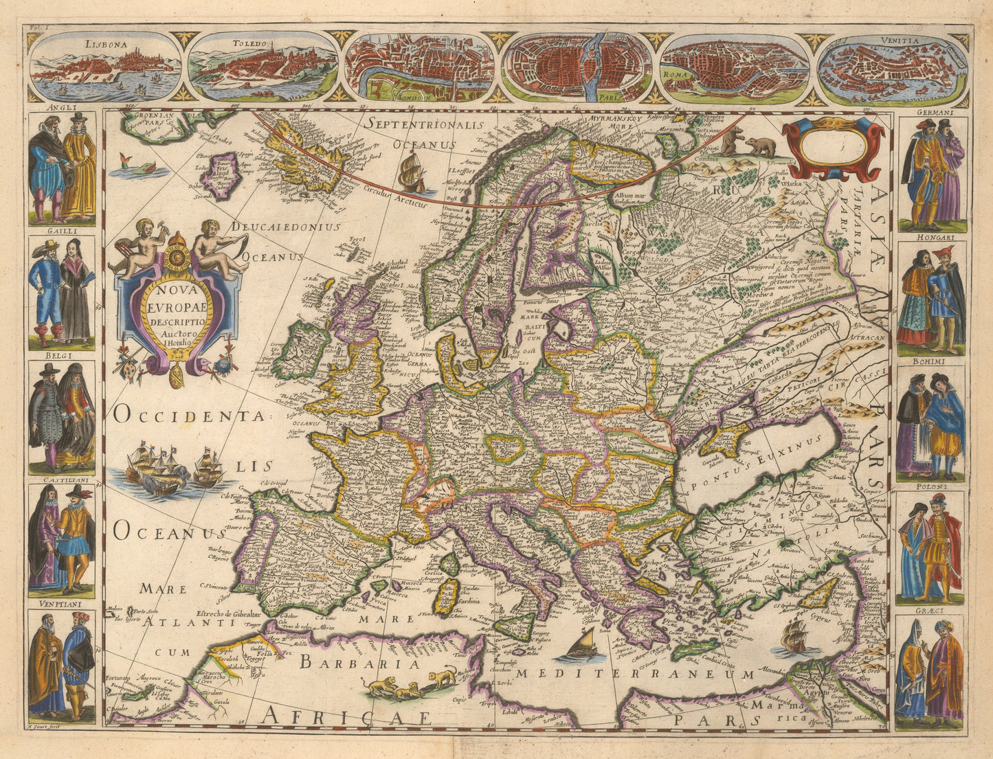
By: Jodocus Hondius
Date:?1659 (published)?Amsterdam
Dimensions:?16 x 22 inches (40.5 x 56 cm)
This is a fine print reproduction of?Hondius's?iconic map of Europe produced during the golden age of Dutch map making.
The map shows in detail the geo-political landscape of early 17th century Europe and extend far enough to include the northern coast of Africa, the Holy Land, Asia Minor, Russian Europe, Iceland, part of Greenland, and the mythical island of Frisland.
The upper frieze contains nine bird¡¯s eye views or maps of important European cities, including (from left to right) Lisbon, Toledo, London, Paris, Rome, and?Venice. Flanking the map are ten portraits of various peoples dressed in their traditional garb of the era.
The map is lavishly embellished with numerous sailing ships, some in battle, and vignettes of three bears in the northern portion of Russia and three lions in Northern Africa.
Inventory #57802