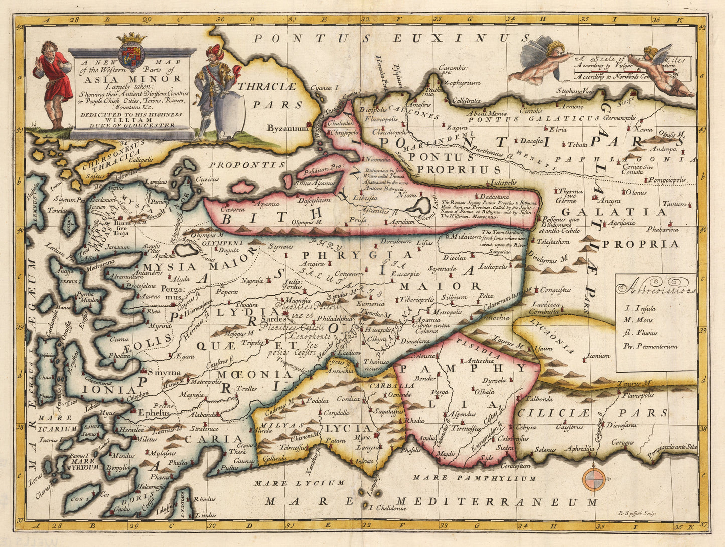
1700 A New Map of the Western Parts of Asia Minor
1700 A New Map of the Western Parts of Asia Minor
Nie można załadować gotowości do odbioru
A New Map of the Western Parts of Asia Minor Largely taken: Showing their Ancient Divisions, Countries or People, Chiefe Cities, Towns, Rivers, Mountains & c. Dedicated to his Highness William Duke of Gloucester
By:?Edward Wells?
Date:?1700 (Published) Oxford
Dimensions:?14.25 x 19.4 inches (36.2 x 49.3 cm)
This is a fine print reproduction of a striking map?by Edward Wells that?depicts much of Anatolia, from slightly east of Ankara.
It shows the ancient geography and place names of much of Anatolia, eastern Greece, and a number of Greek islands. The area depicted includes much of the southern coast of the Black Sea in the north, to Lemnos, Keos and Cos in the west and south, along the Mediterranean as far east as the ancient and strategically located port city of Pompeiopolis, where products from the magnificent Taurus mountains had been traded from time immemorial.
Inventory #11230