1636 Fezzae et Marocchi Regna Africae Celeberrima
1636 Fezzae et Marocchi Regna Africae Celeberrima
Couldn't load pickup availability
By: Willem Janszoon Blaeu
Date: 1636 (circa) Amsterdam
Original Size: 15 x 20 inches (38.1 x 50.16 cm)
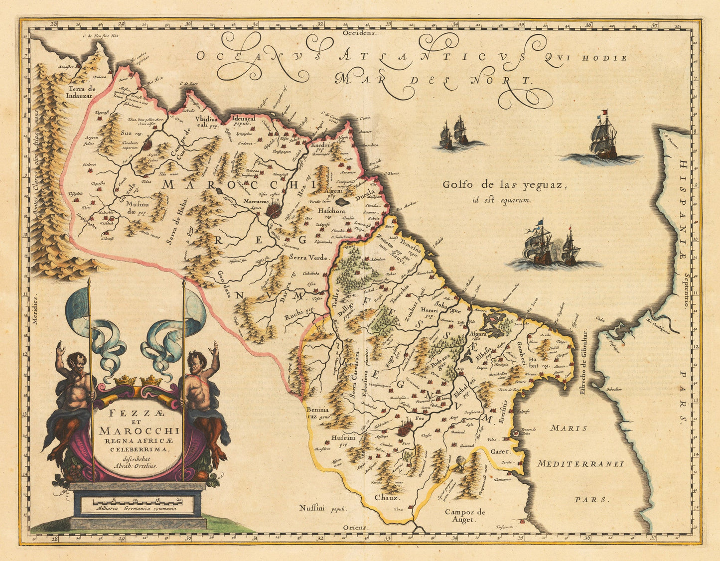
This is a reproduction of an authentic antique map of Morocco by Willem Janszoon Blaeu. The map published in Amsterdam circa 1636.
This comprehensive map of Morocco orients to the west and shows the area in lavish detail from the Atlas Mountains in the south to the southern coast of Spain, whom controlled portions of this area from 1580 until 1640 along the coast at Ceuta, Tangiers, and Arzilla. Engraved in Blaeu¡¯s traditional style, mountains, forests, and river systems fill the empty spaces. Several towns are mapped with Taradante, Fez, and Marakesh highlighted in red.
The sea in embellished with several sailing ships, two of which are at battle. In the lower left is a large, ornate title cartouche featuring two satyrs holding large flags. Abraham Ortelius is credited within the cartouche for his 1570 map of the area. A scale of Germanic miles is included within the base.
Inventory #18684