1
/
of
1
1655 Vintage Map of Paris
1655 Vintage Map of Paris
Regular price
369,00 zł PLN
Regular price
374,00 zł PLN
Sale price
369,00 zł PLN
Taxes included.
Shipping calculated at checkout.
Quantity
Couldn't load pickup availability
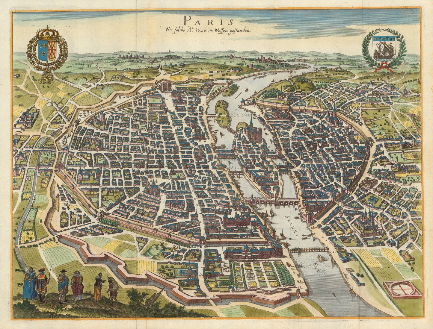
Wie Solche Ao. 1620 im Wessen Gestanden
By: Matthaus and Caspar Merian
Original Date: 1655
Size of Original: 13 x 17.5 inches? (35 x 47 cm)
This is a fine print reproduction of a marvelous bird's eye view of Paris that provides a clear image of the city and its immediate environs as of 1620.
The map is oriented east with the Seine shown running close to the center, highlighting Ile de la Cite and its architectural edifices. Notre-Dame rises prominently within the original city of Paris. The cathedral's construction began in 1160 under Bishop Maurice de Sully and was largely complete by 1260, though it was modified frequently in the following centuries.
The city as it is show in this view from 1655 includes a second set of defensive walls replete with a moat that is clearly rendered. This attractive and colorful map is embellished by two coats of arms on the horizon, and well-dressed figures in the lower left quadrant.
Inventory #81028