1
/
of
1
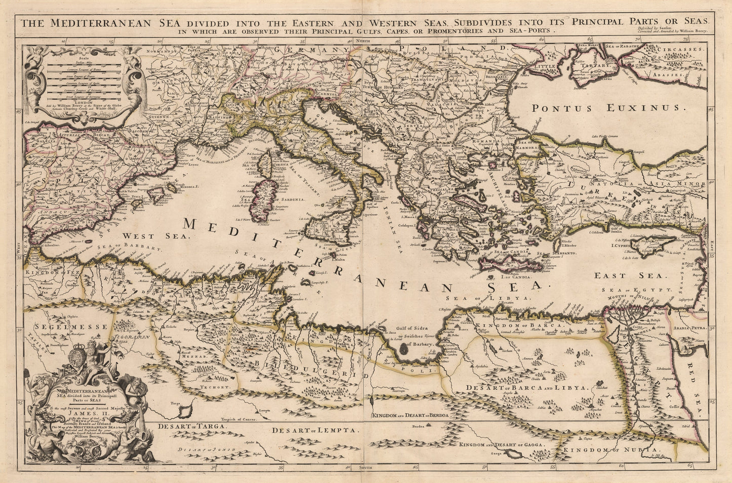
1685 Mediterranean Sea divided into its Principall Parts of Seas
1685 Mediterranean Sea divided into its Principall Parts of Seas
Regular price
528,00 zł PLN
Regular price
533,00 zł PLN
Sale price
528,00 zł PLN
Taxes included.
Shipping calculated at checkout.
Quantity
Couldn't load pickup availability
By: William Berry
Date: 1685 (Published) London
Original Size: 22.25 x 34 inches (56.5 x 86.4 cm)
This is a fine print reproduction of very scarce map of the Mediterranean Sea, its entire coastline, including much of the Ottoman Empire as it was in the late 17th century.
The map is dedicated to King James II of England in the year he ascended to the throne, and just three years before the Glorious Revolution which saw him abdicate, and William III and Mary II take his place. The elaborate title cartouche includes heraldry, allegorical figures and a dedication ¡®to the most Serene and most Sacred Majesty James. II. By the Grace of God King of Great Brittain France and Ireland this Map of the Mediterranean Sea is humbly Dedicated and Presented by your Majesties Loyall Subject and Servant William Berry.¡¯
William Berry was a bookseller, geographer and engraver who was active from about 1670 to 1703. He corrected and amended a set of maps by Nicolas Sanson which were frequently referred to as the ¡®English Sanson Collection¡¯. They were very rare and highly sought after. Due to the strong Dutch school of cartography in the 16th and 17th centuries, few English mapmakers reached a high level of distinction. Berry was an exception, producing maps that would compete with respect to accuracy and beauty with those of the great Dutch mapmakers.
Inventory # 11192