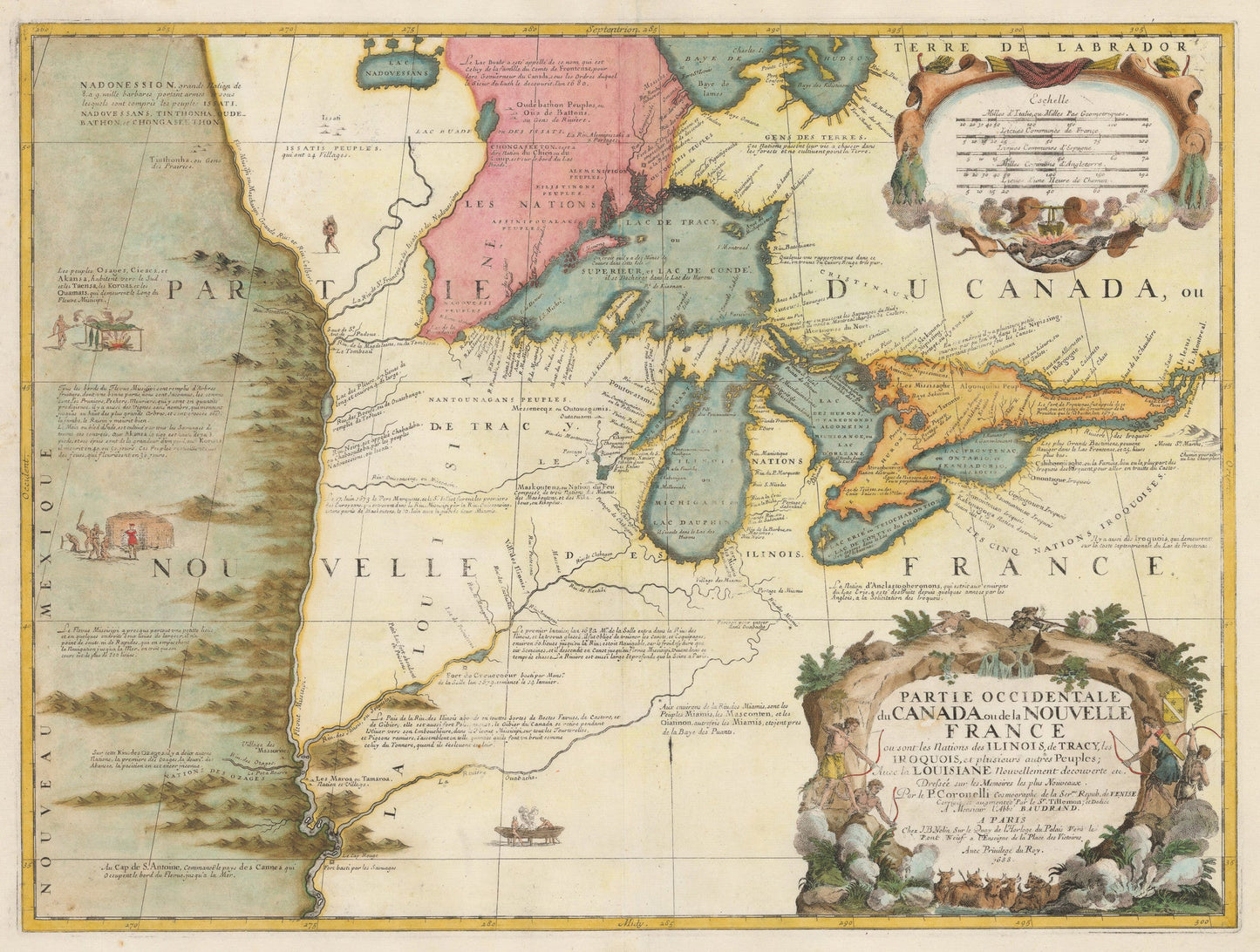
1688 Partie Occidentale du Canada ou de la Nouvelle France...
1688 Partie Occidentale du Canada ou de la Nouvelle France...
Couldn't load pickup availability
By:?Vincenzo Maria Coronelli
Date: 1688 (dated) Paris
Original Size: 17.5 x 23.25 inches
This is a Vintage Map Shop reproduction of the earliest map to focus on the upper Mississippi River and Great Lakes Region, by Vincenzo Maria Coronelli.
Published separately in 1688, many contemporary sources were drawn from for making the map including Joliet, Marquette, Hennepin and La Salle. The map would remain the standard for the next half century as it provides evidence of the robust and multi-faceted exploration of the region by the French in the second half of the 17th century.
The north shore of Lake Erie depicts the three peninsulas for the first time. The Mississippi River system is highlighted, and marks the cutting off point for place names. A long ridge of mountains is drawn to the west of the river, referring no doubt to the Rocky Mountains. Beyond them we find scenes of indigenous peoples going about their daily lives. Considerable attention is given to the various indigenous tribes and the areas they inhabit. To the east of the river is depicted the making of a canoe.
The scale of miles cartouche includes the unnerving depiction of a human torso being roasted on a spit. The title cartouche depicts Europeans with muskets defending themselves at the top of a rocky outcropping, at the bottom of which a group of scantily clad men are aiming their arrows at a small herd of cattle.
Inventory #10758