1700 Carte Particuliere d¡¯une Partie d¡¯Asie...
1700 Carte Particuliere d¡¯une Partie d¡¯Asie...
Couldn't load pickup availability
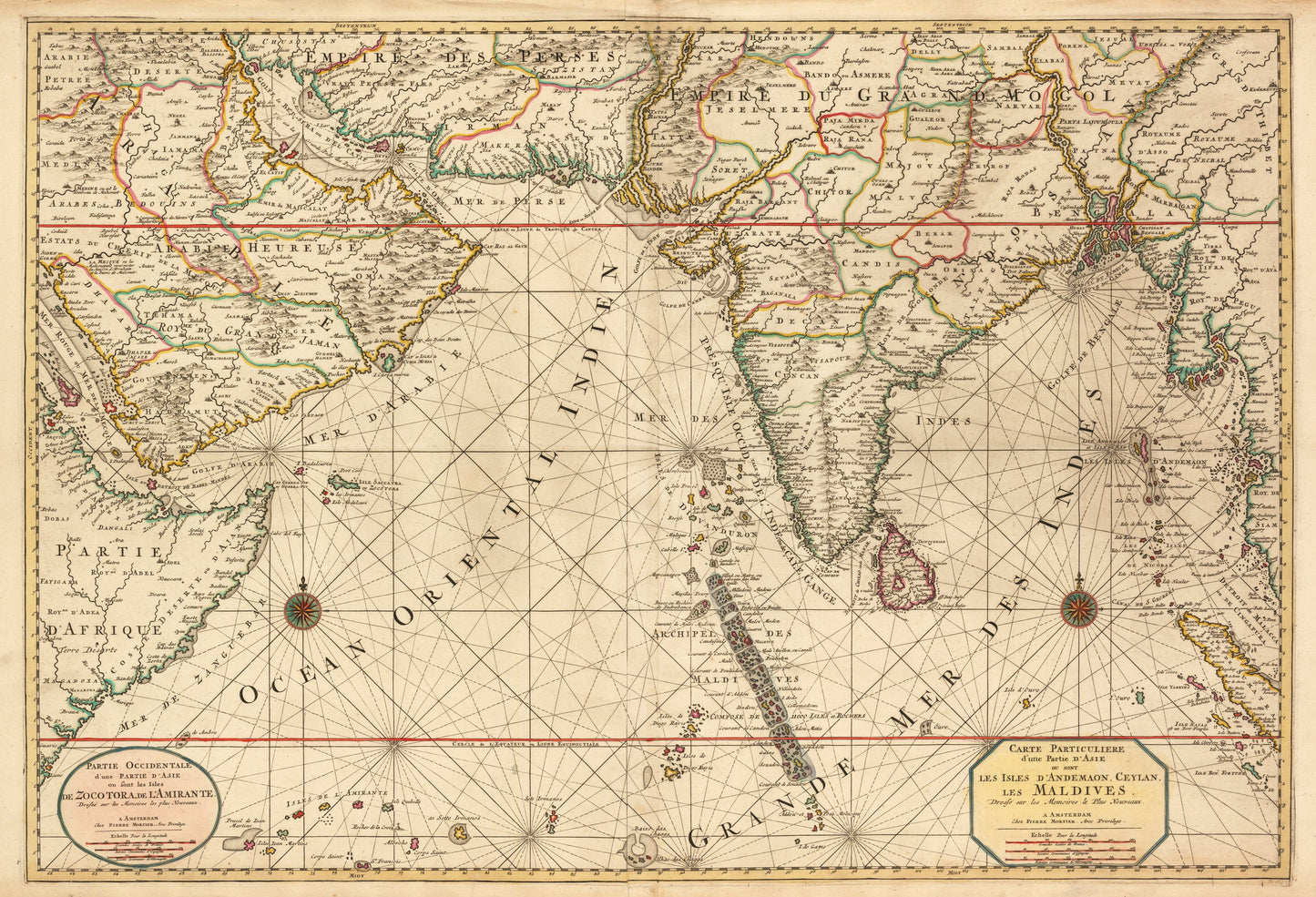
Carte Particuliere d¡¯une Partie d¡¯Asie ou sont les Isles d¡¯Andemaon, Ceylan, les Maldives¡
By: Pierre Mortier
Date: 1700 (Dated) Amsterdam
Original Size:?23.5 x 34.5 inches (59.5 cm x 88 cm)
This is a fine print reproduction of a fantastic example of Mortier¡¯s map of the Asian Subcontinent, Arabian Peninsula, and Horn of Africa.
This map has two titles of apparently equal weight. Each cartouche includes scales of French, Spanish, and German leagues. There are two compass roses, one in the Arabian Sea off the coast of the Horn of Africa and the other south of the Bay of Bengal. While much interior detail is provided, the map¡¯s focus is on sea navigation.
Multiple rhumb lines crisscross the waters, and great detail is offered on island chains, such as the Maldives, Andamans, Nicobars, Seychelles (Amirante), and Socotra. Sandbars and shallow seas are indicated with stippling in such coastal areas as the Indus Delta, the Persian Gulf, and the Red Sea.
Inventory #19262